
Yesterday we decided to go out for a drive. Our destination was the Caldera hot springs which I hear are nothing remarkable, but since they are in our area I wanted to see them anyway. We fired up Google navigation and set out up Via Boquete and then down the Caldera road.
We proceeded through beautiful scenery, through the town of Caldera, and beyond. The road got worse. The ups and downs got steeper. We felt more and more like we were far from any civilization. There were no houses and no other cars on the road. Finally though, we came to the intersection where google told us to turn. That road looked quite a bit worse and google said we were still 6 miles from our destination. I was driving our little old Mazda 323, definitely not a back country, rough road kind of car.
I decided we should forget the hot springs and continue on. Eventually we had to end up somewhere, probably Gualaca and from there we could get back home on better roads. So we drove, and drove… no houses, no other cars, very steep ups and downs, hairpin turns, and we didn’t seem to be getting anywhere. We climbed and climbed, and the plants and trees were telling me we were at a higher elevation. Eventually we start seeing more houses, and then suddenly there is a good road with painted yellow line down the center. Yeah!! How encouraging.
But still, we drove on, and climbed higher and higher. I was way too busy to take photos so I enlisted Joel for that job. I should have thought of it before but as you will see, we caught the most beautiful parts of the day.


We were thankful for the better road, but we still didn’t seem to be getting closer to anywhere and I considered turning around. There is no internet connection up there and it’s hard to make sense of the little map on the phone. I thought we were headed in the general direction of Hornito which was OK, a town big enough to be on the map, and a place we could ask directions and get oriented, so I continued on.


Finally we started to see a few houses which was encouraging. We were still climbing though, and the views were amazing.


Suddenly we reached the end of the road, and saw that the road it intersected had a ton of traffic. Yeah! I felt like we should turn right but not having a good sense of direction, I pulled over to see if I could make any sense out of the map on the phone. We were headed towards Rambala? No, wrong direction. Thankfully there was a very nice man walking along the side of the road who set us straight. We were right in the first place and shouldn’t have turned around.
We were still high up though, and it took a while to get down to Gualaca. I intended to go straight down to the PanAmerican highway from there. But I took a wrong turn in Gualaca and ended up on a road with very little traffic, so I knew I was off course. The little phone map said we were generally headed towards David so I kept going, and eventually we realized we were either on the Caldera road or headed in that direction. This turned out to be a good thing because it was the most gorgeous scenery of the whole day.


I think altogether we drove about 2 1/2 – 3 hours. I’m glad we went out and saw some areas we weren’t familiar with, and if we go again we will have a much better idea of where we are. I found our route on a map and I think there is a much shorter side road to the hot springs a bit farther down the road. Maybe we will try again sometime, or I’ll just take the offer of other friends who have more suitable vehicles.
It was a great day but of course, it’s always nice to get home again too.
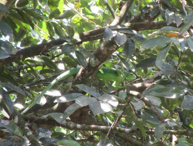
Home again. Can you spot the baby iguana in the tree?
A special thank you to Joel for all the great photos!


Jeez, I didn’t know Panama had roads like that! Cool. We may have to check it out. Thanks!
LikeLike
Like what? Paved with yellow lines, or full of holes and rocks? Yep, you can find pretty much any condition of road here.
LikeLike
Hola Kris,
The link is a google map of roughly the route I took about a decade ago when trying for a mirador above Boquete for a photo session. Nena’s mom and sister were with us on my spur-of-the-moment decision in a tiny rented car we named, “Frijole”. It was afternoon when we crossed the bridge and started the climb. At the top we saw the giant culverts channeling the water to reservoirs (probably built by the Euro expats of the day). The “road” went from blacktop, to gravel, to stones, and finally just ruts. When passing the culverts, I asked a campasino if a car could keep going on the rapidly deteriorating roadway? His advice was to get a cuatro por cuatro, a car had no chance. I decided a little further would be OK.
The short version is, we finally emerged from the jungle somewhere near Mague on the Caldera road, about 9 PM. As you say, a road with a yellow strip! Civilization! We still had NO idea where we were until we intersected the Boquete Road. We picked up a young man who was waiting for a bus to Boquete and after the shock of seeing 3 Boquete ladies with a gringo chofer, he asked where we were coming from? Nena tried to convince him we had driven from Boquete to almost Caldera through the mountains but he said, “no”. Not possible. Never underestimate the stupidity of a gringo chofer because we had done it.
jim
https://goo.gl/maps/6YXSwhqKgmw
LikeLiked by 1 person
LOL. Oh my, good think you all and the frijole made it through! The google map routed you on a much more sensible route, but I think I see the faint lines for the rural roads and ruts that you probably took. Good job, gringo chofer ! 😀
LikeLike
We use WAZE app for directions, but I still love taking roads we have never been on. Looks like you were on some of the same roads we have explored when driving from David or Boquete to Bocas de Toro or back to Pedasí. Get to see so much more. And if you come to a dead-end, you can always turn around and go back the same way you came. Used to do this in California as well.
LikeLike
WAZE is good. We use it quite a bit too. You could have wound up in that area on your way to Bocas. That was the road where we eventually landed.
LikeLike
Yay! Another adventure – glad it turned out alright!
LikeLike
Yep. I figure you can’t too far gone in this small country, though as Jim told above you can find plenty of impassible roads
LikeLiked by 1 person
Yes, and I love reading Jim’s comments – to just about everything. I’m becoming a big fan of Jim’s 😀
LikeLike
He knows so much about Panama and Chiriqui that he can be really helpful 🙂
LikeLike
In my defense, most of our yearly vacations were spent in Panama for the last 40+ years; much of that time in Chiriqui although I have been lost on the back roads of the canal zone as well. I always assumed that having Nena’s family along would keep me on track but it turns out that “I” was the only one taking folks on trips around Panama. Nena’s family did not own a vehicle until her older brothers moved to Panama City to find work. Even back then, Boquete’s young were leaving for better opportunities in the “Big City”. Nena and her sisters were the same, Nena was a sales girl at the Toboga department store when I met her.
Spending 40 years surrounded by tales of growing up in Chiriqui gives one a real feel for the culture of the area, if not the geography!
METO!
PS, I do recommend a trip to see the culvert system up there. I am convinced a ride through one of those would be better than WetNWild. But, take a change of warm clothes, the water is below freezing.
LikeLike
No defense needed! I really appreciate all your input and everything you share with all of us. I don’t know about the culverts and freezing water though…. 😀
You are right that many Panamanians don’t travel much, not even in their own province. My car owning neighbor had never been to Boca Chica or Cerro Punta. We had fun changing that.
LikeLike
On one of our visits in Panama as part of our tour we went to the hotsprings with motto. Quite an experience, road was muddy and rocky, had to use horses to get to it. There is a family that lives near it that has a lot of tropical animals like monkeys. Whe then walked slowly because you could sink in the mud up to your ankle, it was raining. Moti our guide had them deliver a cup of Panamanian coffee for us, great experience. Probably could visit it with mote, he can add it to a tour for you when you visit the sugar area. Well worth the experience, only bad thing while on the hoses was going uphill, it was pouring out with thunderstorms. Would not recommend going yourself, but well worth the trip. Very rough road and a little walking .
LikeLike
Good point! Better to go when conditions aren’t wet and muddy. I have friends with 4×4’s so maybe I can tag along sometime. Forgot about Moti. Yes, we could get a group together and plan a tour.
Hope all is well with you 🙂
LikeLike
My husband is still in France , returning tues. things moving slow here.
LikeLike
Moving at any speed is still good, and glad to hear he will be back soon
LikeLike
Wow. Stunning scenery!
LikeLike
It’s a gorgeous country. Glad you enjoyed the photos 🙂
LikeLike